The weather has changed, become cloudy, and tomorrow will be rainy, so we agreed to spend today ‘on the top’ and tomorrow’ down the bottom ie in the Park.
The top involves some dodgy driving, planned months back. My intention was to at least photograph the Bloukraans River mouth. This place is where a significant family event took place in the winter of 1976-7, when we ie Hilary, and the four girls, walked the Otter Trail, a 45km trail along the coast, across river mouths (the Kleinbos, Elandsbos, Bloukrans, & Groot Rivier), on the rocks and in the rain forest on the edge of the cliffs facing the Indian Ocean.

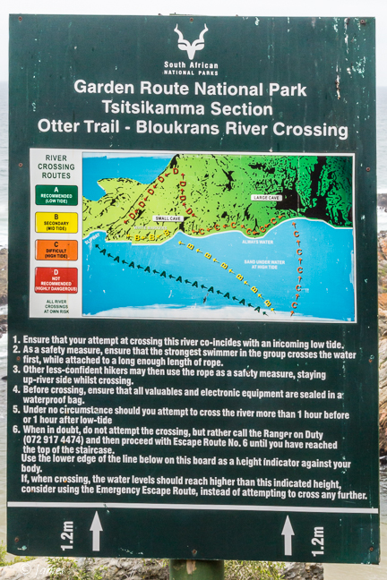
It can only be walked from east to west (from the Park Office to Natures Valley, and walkers should keep to the stages between rude log shelters. The stages vary from 4.8km to 13.8km per day. We were naive, and not prepared as well as we should, having never walked a trail before. The trail must be booked a year ahead as it is so popular, and restricted to 12 per day. As a result we met no one for 5 days. Day 4, the 13.8km part, requires crossing the Bloukrans River. It is impossible at high tide so it is necessary to plan for a low tide crossing. We understood that it is only possible to cross 1-2 hours either side of the tide change, so we planned to cross near low-tide about 4-5pm leaving us sufficient time to then walk the 45 minutes to the next shelter before dark. We arrived on time to find the waves rolling in over the sandbank, still too high for the girls especially, and for me who would have to take each across and throw them the last 2 metres across the deep channel against the far side rocks. So we sat waiting for the tide to go fully out, becoming more concerned as the weather changed as it did today. The clouds covered the moon. I kept testing the water, and decided we would have to try by 7.00, as I was unsure when the tide would start to rise again. I was very concerned about the situation, so we all prayed for help in the crossing, then walked into the water. It did not part(!) but the clouds did, allowing the moonlight to peep out as we walked the 50cm deep water on the sandbank. Hilary crossed first, swimming the 3m strong stream on the far side, against the rocks. I threw the bags over, standing on the edge of the sand up to my waist, then each girl went across with a push from me, and lastly myself. As I crawled up the rock Hilary exclaimed “Whats in the water?” I turned around and there they were – the otters, which are seldom seen! And with that, the clouds moved over the moon again. Coincidence? Don’t think so.
We still had 3.5km to walk to the next shelter, but the rain held off. Hilary had good night vision so she led and we kept a good pace when she suddenly stopped, looked right, and said ‘Is that the hut?’ It was. We were dead tired, it was late, but we were under a roof – and the rain fell. Dinner was out the tin.
It would not be possible today; the youngest was 7; now the age allowed is between 12 and 65. There are two huts that sleep 6-people each at the end of days 1 to 4. The huts are equipped with bunk beds and mattresses. There’s a toilet (often with a scenic view), a braai area with firewood, a cold shower, a rainwater tank and a bag/bin to dispose of rubbish.
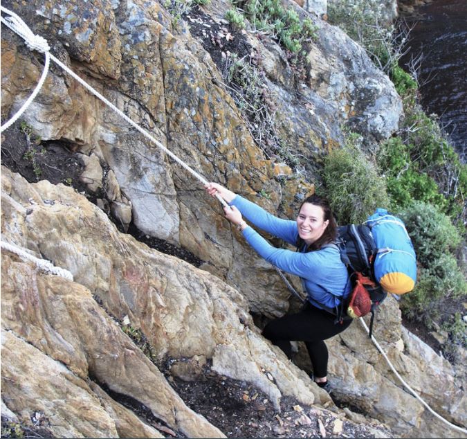
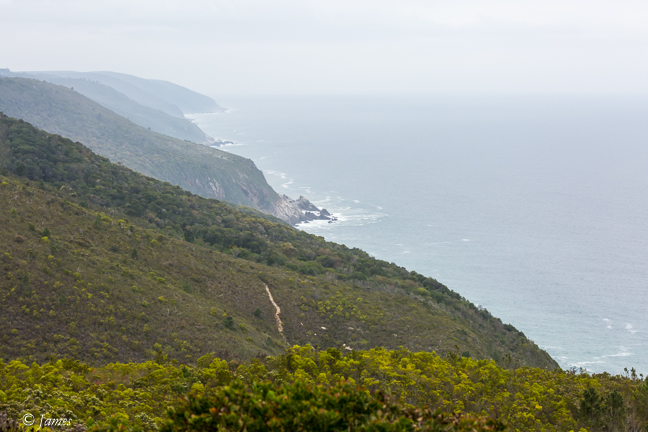
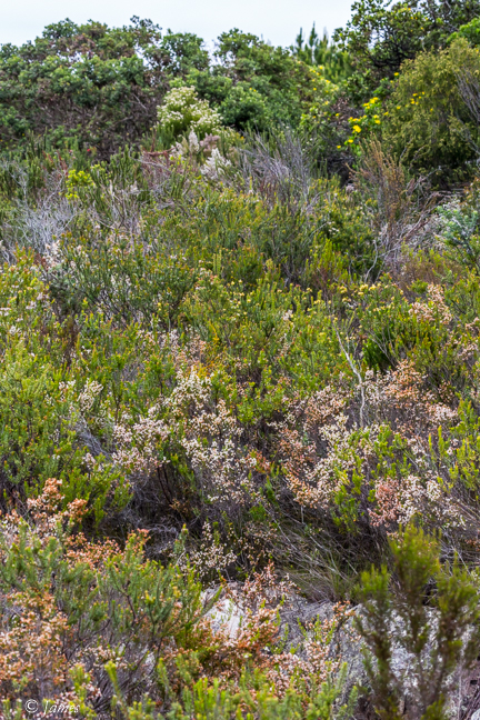
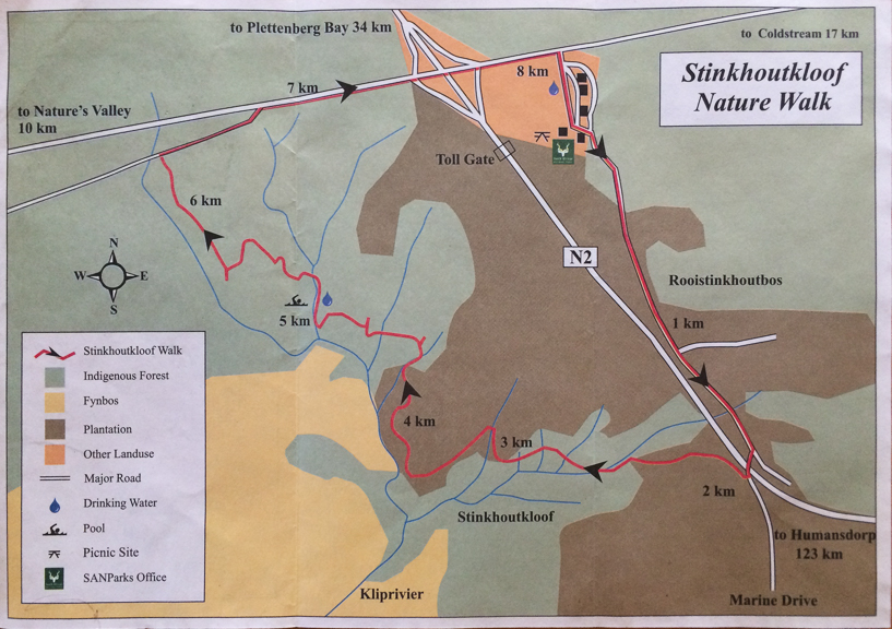
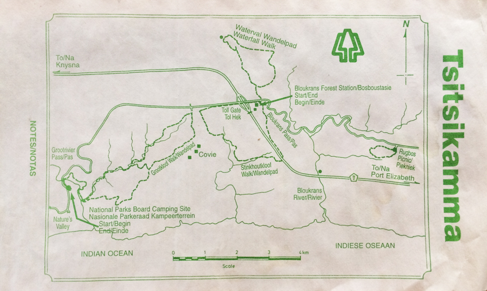
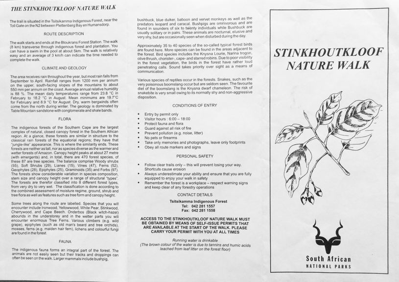
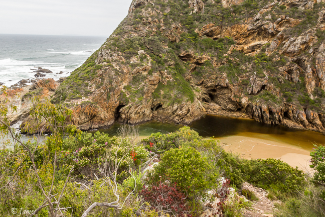
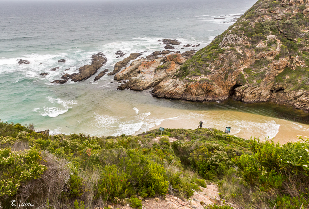
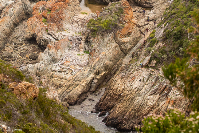
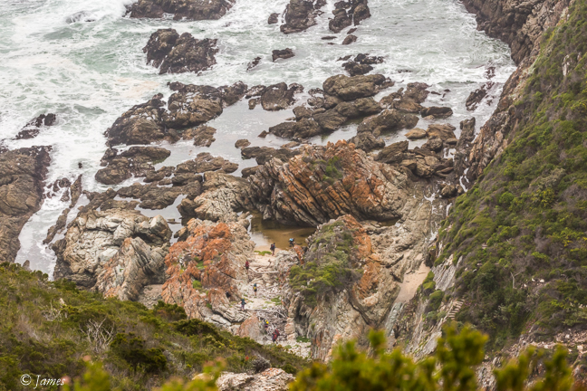
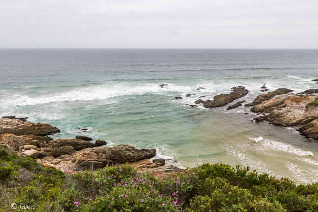
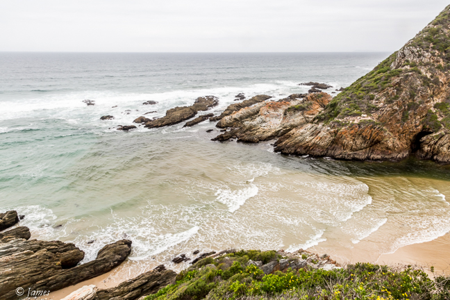
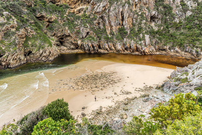
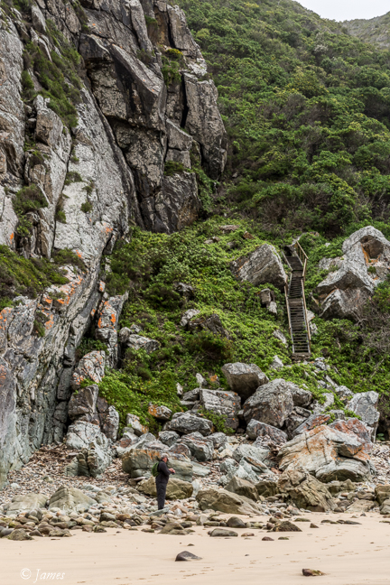
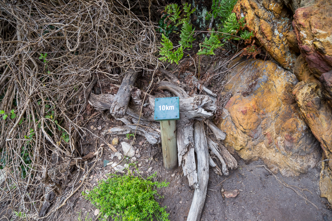
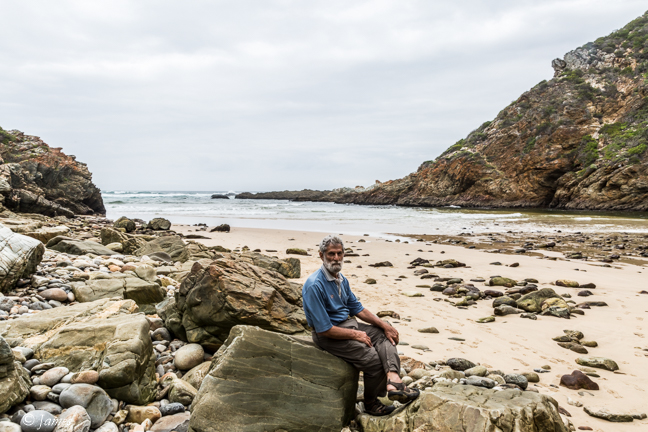
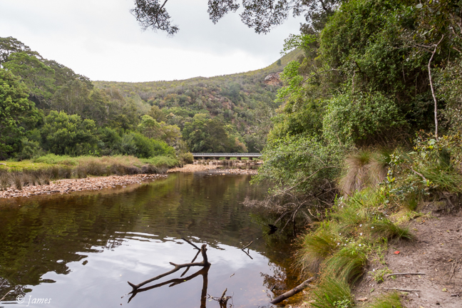
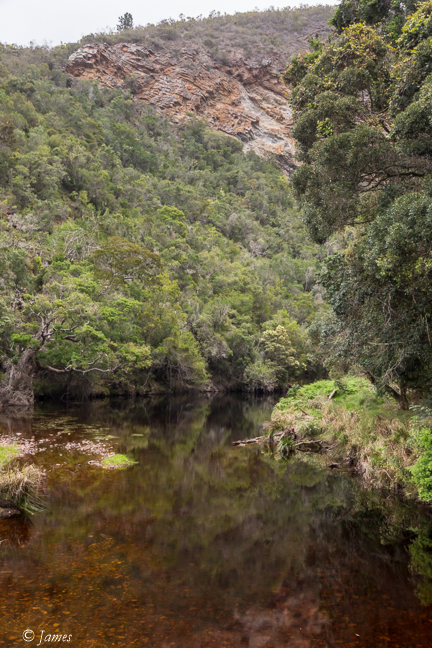
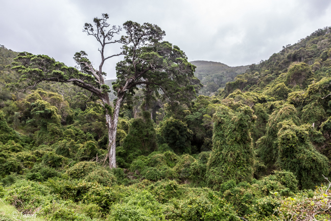
So today we drove to the west of the Bloukrans (the border between Western and Eastern Cape) through the toll, then down the old road to the Forest Station, where we asked permission to travel into the forest plantation as no entry signs proliferate at the entry points. The process is simple – a self check-in of a form at the gate. David drove us to a point on the bluff as near as possible to the river mouth, but it was not possible to walk through the thick fynbos scrub. So we decided to try on the east side, a longer more complex route, from the Coldstream logging camp. The no entry signs were up here, and no self check-in, so we were a little concerned. The tracks are for logging so are rough, but we eventually made it to the point where the Escape Route 6 track to the river mouth starts, having past forestry people. I couldn’t wait to go down, but it is very steep, the steps are often almost vertical (logs pinned to the ground). The tide was coming in, the clouds were dark, just as they were so long ago. I was grateful as a hot sun would have made the climb out even tougher – I had to stop several times to recover. But there it was, the rocks and sand where we crossed, the deep tannin-stained water meeting the incoming sea. I spent 30 minutes on the beach before climbing out. There is now a board detailing three possible crossing points dependant on the water level, though I would not have liked the other two that night either – they are not easy along the vertical cliff face on the west side, requiring the use of ropes.
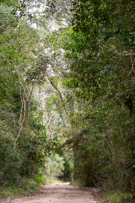
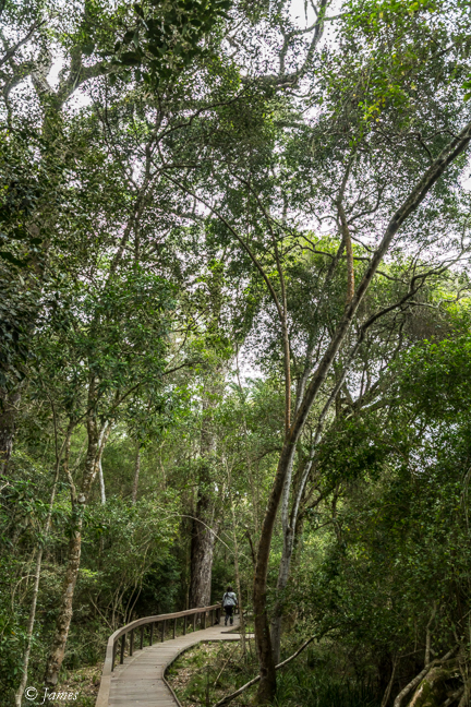
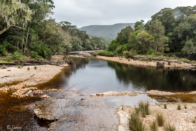
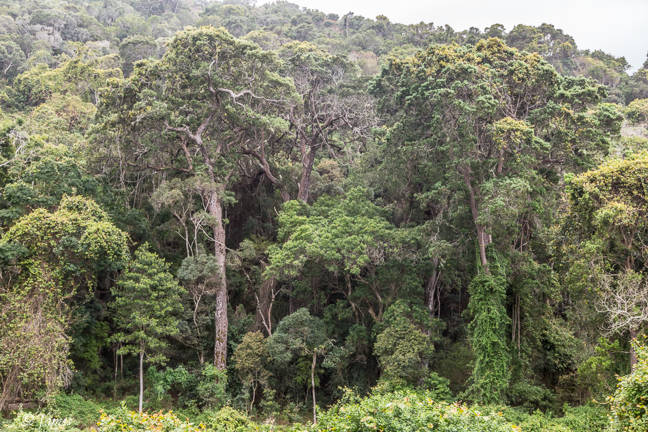
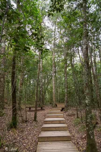
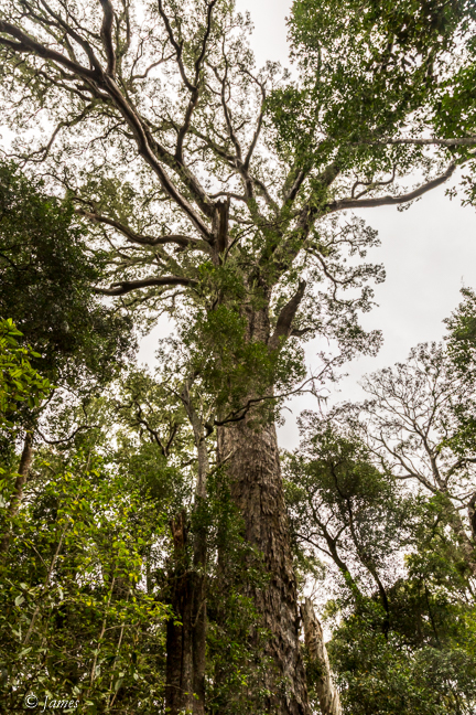
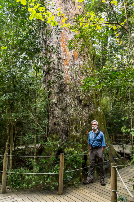
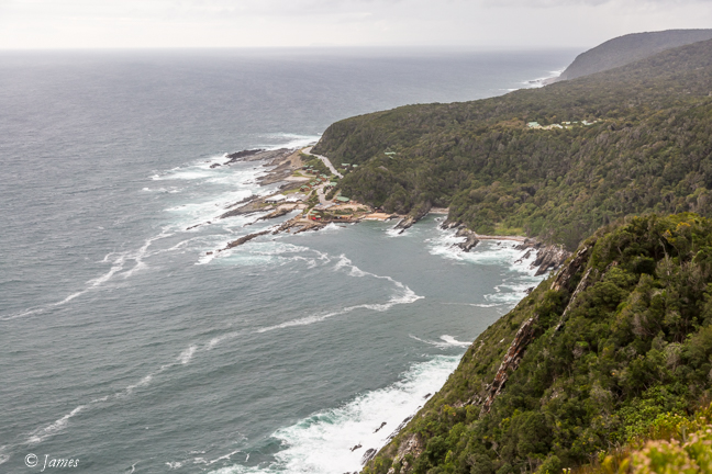
We found a shorter way out to the highway, and then to the old road bridge across the Groot Rivier, where my stepmother leaned on the rail and I took a photo with the old 127 Brownie box camera in 1963. The short walk into the forest is delightful – the only sound the birds and water. On the way out I met a couple celebrating their 50th wedding day, by travelling this area where they once lived. They too are Christian (Brethren in the past) and have similar fears for the future. Lunch at the cute Crags Farm, above Natures Valley, returning to the Big Tree (it is) near Storms River (Ratel) Trail). The yellowwood trees are very tall, looming high above the forest. Logged extensively in the past, they are now protected. We crossed the high Storms River bridge (bungee possible here) to another track to find the spot overlooking the Storms River Park Office and accommodation on the beach, from the west. (If I had looked at the maps I have, I would have seen it marked as ‘Look out’! We drove there from the town but found a shorter way back. The lookout offers a full view of the Park Office area, including the refurbished chalets we stayed in in the 80’s. At that time the bridge seemed a waste as it lead nowhere ie there was no way up the hill; now the Dolphin Trail leads down to the river, so I was surprised to see several people come up while we were there. The east wind was very strong standing on the platform. A crew were pinning a satellite dish to the ground in preparation for the Otter Trail Run within the next 2 weeks, an event that is now world renown. Apparently a cycle race through the forest is another popular event according to Mike the owner here at Andeloni. I cant imagine how tough these would be.
Dinner tonight was at the up-market Tsitsikamma Village Inn, an extensive accommodation place, with a large beautiful dining room, and good food.


Old Groot Rivier Bridge 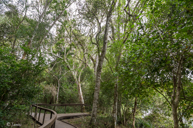
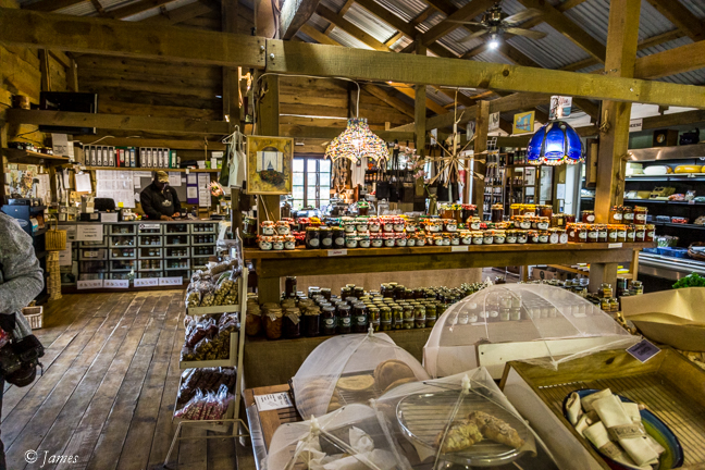
Crags Farm 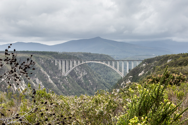
Storms River bridge 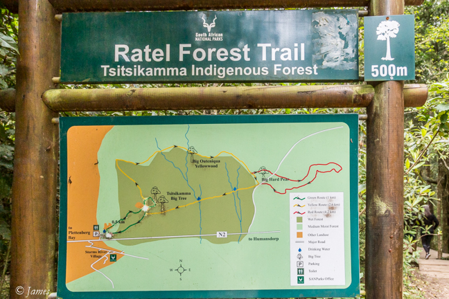
Storms river mouth 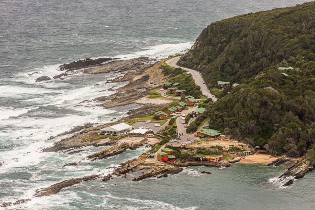
Storms River Camp 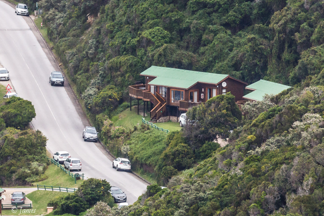
Our chalet at Storms River
Tsitsikamma Village Inn 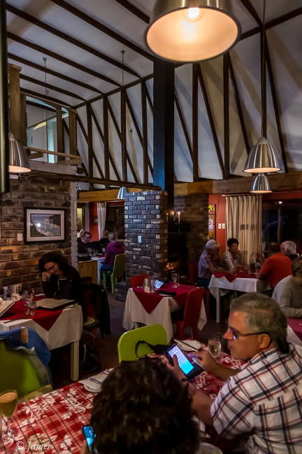
such great memories! thinking back on it now – goodness me you and mommy were either brave or stupid! fancy taking 4 young children on such a walk. but I am so glad you did. that is a memory for all of us now that we all love to talk about and remember. what an achievement. and so exciting for us. I don’t remember finding it difficult, I remember loving every minute.
Glad you enjoyed it! Didnt start weii for you. Good times