One can easily spend a week around Cape Town visiting the beautiful neat wineries, white gabled homes set against the high mountains, the cableway up the mountain, Rondebosch Botanic Gardens, many places in the city, walking trails up some mountains…. I wanted to drive the circuit around the peninsula ranges, which are effectively an island separated from the main ranges 20km inland by the sandy Cape Flats. Muizenberg, the Boulder penguins, Cape Point, the boulders of Oudekraal, finishing on Table Mountain. Ambitious, especially for photographers!
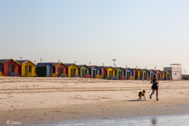
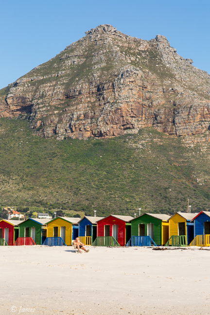
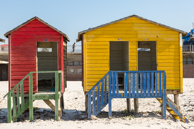
Muizenberg is a popular beach town at the foot of the mountains. The beach is long and flat, tides are small making it safe. The most interesting for us was the long row of brightly painted beach huts. I found it difficult to determine the best composition with such a long line. I was distracted by a guy carrying a sand pump to capture shrimps.
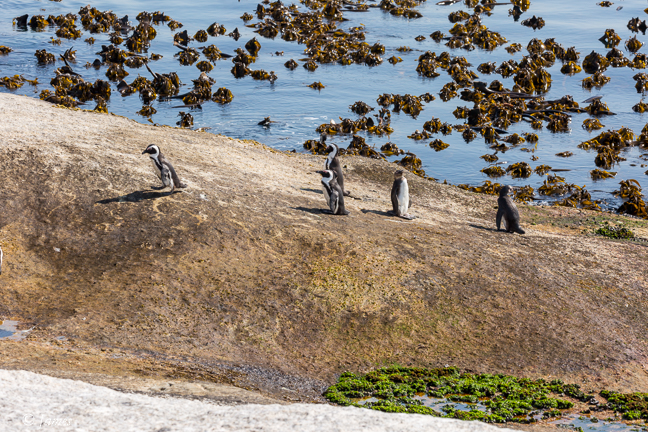
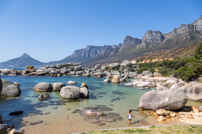
Next was the Boulders Penguin Colony a southern suburb of Simon’s Town. The fairy penguins live on a protected rocky beach. The main part requires entry payment but the car park and a path heading south also offers good views from the cliff edge.
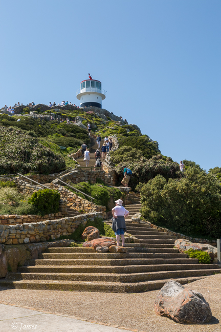
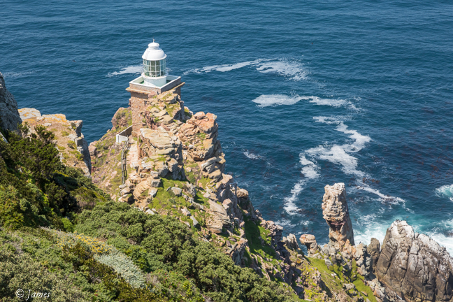
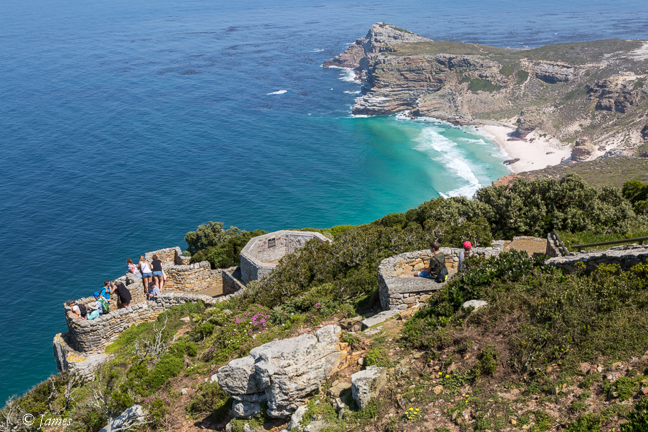
A fast drive took us to the bus-filled Cape Point parking area. A ride on the funicular at the restaurant, or my choice of a climb up the stairs, brought me to the old lighthouse. Several lookout points offer views of the Dias Beach and the new lighthouse at the furthest point.
In 1488, Portuguese explorer Bartolomeu Dias (c. 1450-1500) became the first European mariner to round the southern tip of Africa, opening the way for a sea route from Europe to Asia. Dias’ ships rounded the perilous Cape of Good Hope and then sailed around Africa’s southernmost point, Cabo das Agulhas 100km south east, to enter the waters of the Indian Ocean. Portugal and other European nations already had long-established trade ties to Asia, but the arduous overland route had been closed in the 1450’s due to the Ottoman Empire’s conquest of the remnants of the Byzantine Empire. A major maritime victory for Portugal, Dias’ breakthrough opened the door to increased trade with India and other Asian powers. It also prompted Genoan explorer Christopher Columbus (1451-1506), then living in Portugal, to seek a new royal patron for a mission to establish his own sea route to the Far East.
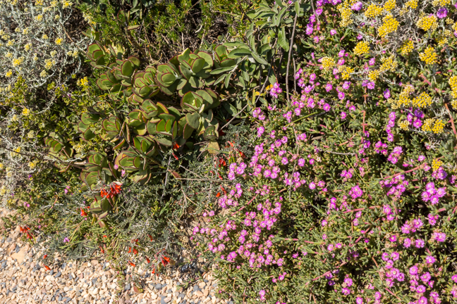
We continued along the eastern edge of the cliff to the new lighthouse on the point, from which one can sometimes see the meeting of the cold Atlantic and warmer Indian Ocean 200m below. It is exposed to the strong winds so the park is covered by low fynbos, flowering at present. This vegetation is related to that of Western Australia and the number of species is also high. The combination of small flowering plants against the sandstone rocks makes a pleasant though strenuous walk.
A quick burger and we headed back toward Cape Town on the west, Atlantic side of the range, partly along Chapman’s Peak road.
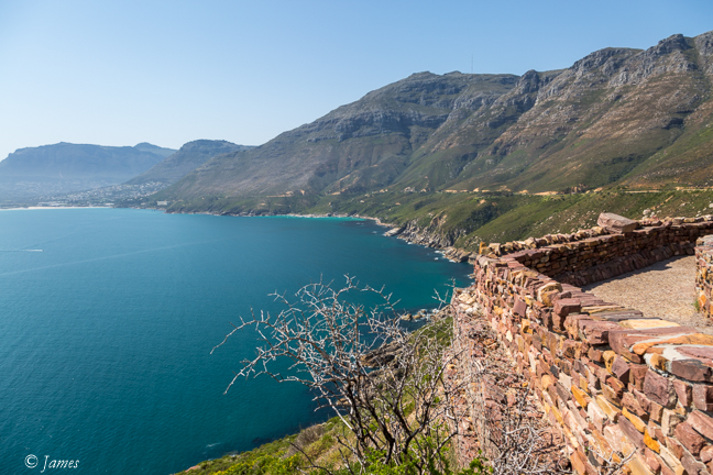
Chapman’s Peak is named after John Chapman, the pilot of an English ship becalmed in Hout Bay in 1607. The skipper sent his pilot ashore to find provisions, and the name was recorded as Chapman’s Chaunce. Chapman’s Peak Drive was hacked out of the face of the mountain between 1915 and 1922, and at the time was regarded as a major feat of engineering. In 1991, the road was featured in an advertisement for Mercedes Benz, in which a 1988 car crash was recreated to illustrate the safety of Mercedes Benz. It is built on the contact of the sandstone lying on top of the granite. The western flank of the mountain falls sharply for hundreds of metres into the Atlantic Ocean, and the spectacular 8km road hugs the near-vertical face of the mountain linking Hout Bay to Noordhoek.
This time we stopped at the small boulder picnic area of Oudekraal at the foot of the mountains (see yesterday). Trees and bushes grow between the huge granite rocks, which also offer a different view of the Apostles. We had planned to shoot here at sunset but time was running out so we quickly took some photos and left for Table Mt.
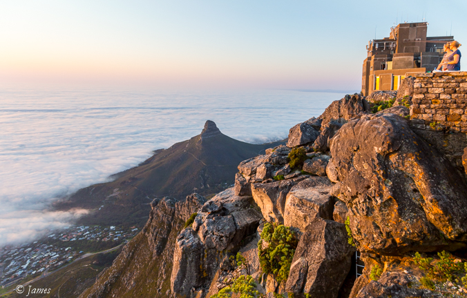
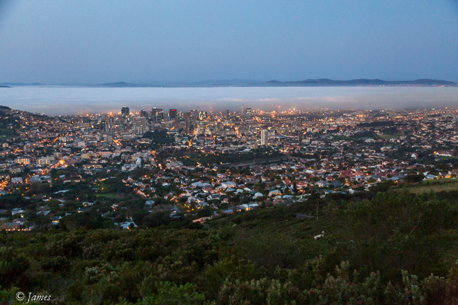
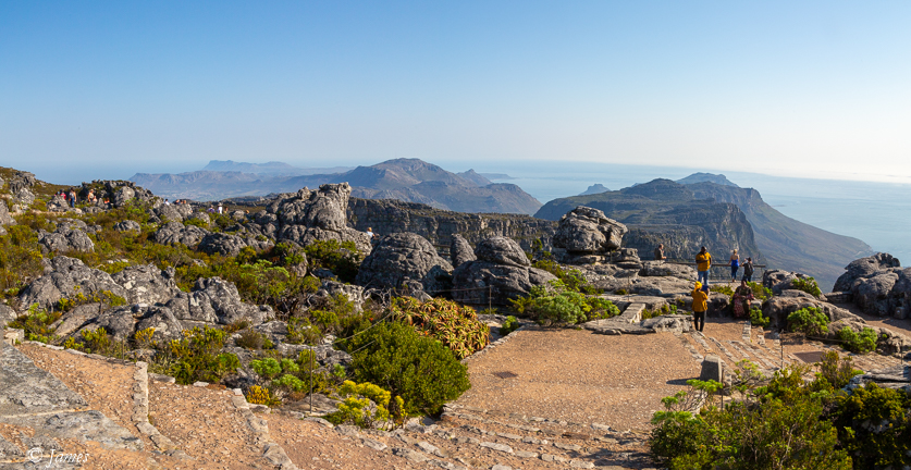
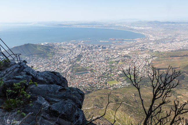
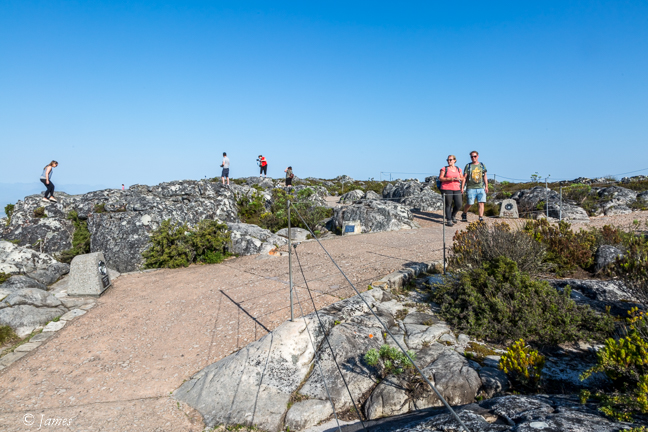
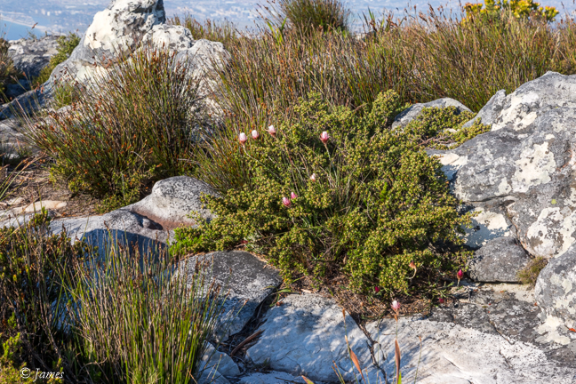
As it was late, the cableway was not very busy,; most were coming back down. The cars rotate on the way so everyone gets a view of the city below. One can climb up several paths or the rock face using ropes. The top is rocky of course, but paths have been made over most of this narrow part affording views north-west and south-east. Like the peninsula, the plants are low due to the extreme climate. Two guys resting after a rope climb were looking out of place with their hard hats, ropes and scruffy appearance. It’s evident that the mountain is popular for cycling, running and hiking too. We stayed to see the sunset on Lions Head, till the last car down at 6, and were rewarded with a fiery red against a blue sky with the table-cloth white clouds creeping in to cover much of the urban area below.
After another meal at the V&A we found the lifts in our building were out. We had to climb 6 double height floors so we don’t look forward to taking our bags all the way down.
Muizenberg 
The Boulders 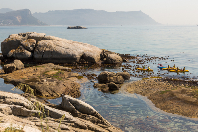
Cape Point 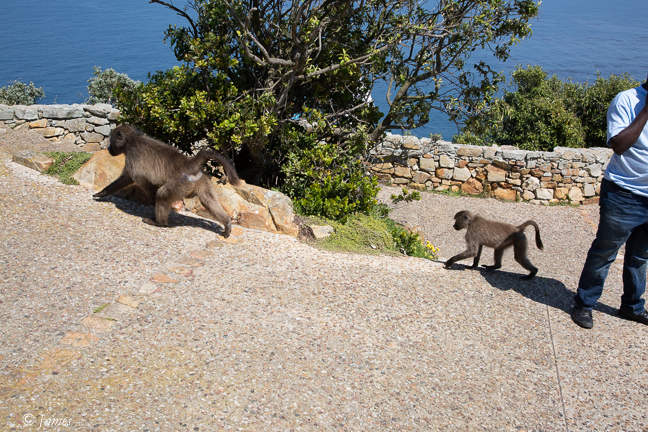
Oudekraal 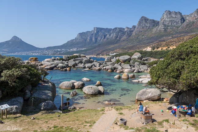
Chapman Peak Rd 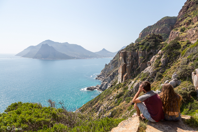
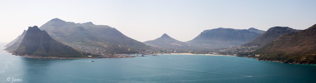
Hout Bay 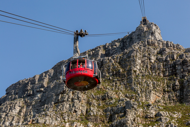
Table Mt 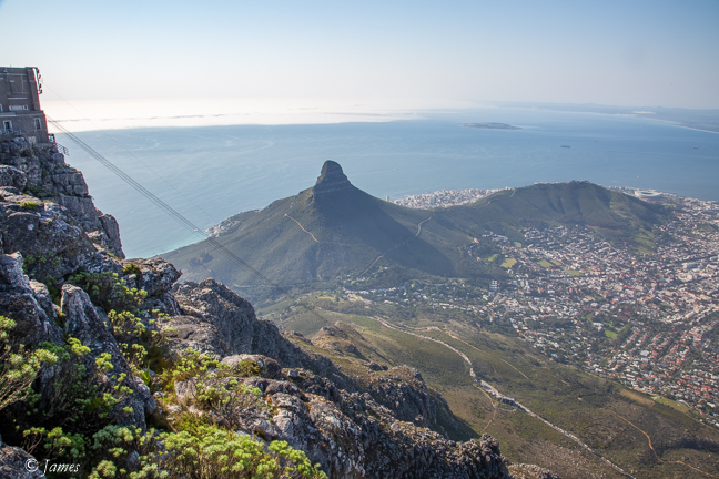
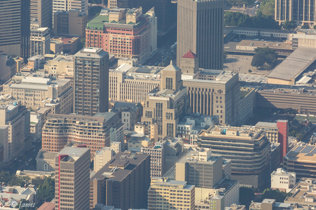
Old Mutual 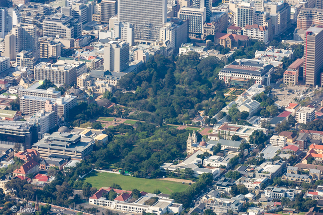
Company Garden 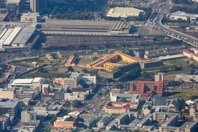
Castle